 Donations are still welcome....
About 10:30 AM yesterday reports from two Kalapana Gardens residents say they witnessed a sudden and “large mushroom-like cloud of steam” rise high into the air directly above the western lobe of the ocean entry. This was likely a newly formed bench of land collapsing into the sea.
The entire length of the ocean entry and all land adjacent to it inland is quickly becoming unstable and should be kept well aware of from now on.
As previously reported; active pahoehoe breakouts continue along with swelling of the hot flow fields at many locations of the April-May surface flow. The coastal entry points have changed somewhat in the past 24-hours, but are still emptying a lot of lava into the sea as new deltas area being rapidly built.
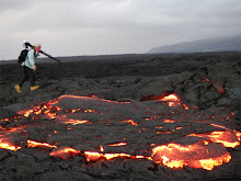
Visitors that walked the mile from the Hawaii County roadside parking lot to the end of highway 130 designated lava viewing site last night reported only seeing a distant steam plume that glowed orange red at times after dark, as well as some lava glows on the distant pali, again, after dark. There was no active lava visible from the designated ‘viewing area’ that I am aware of. But just beyond the new end-of-the-road viewing area lava is still breaking out in places.
USGS lava flow map gives a good indication of the active lava zones:

And a new USGS image page has this good aerial of the lava off the (new) end of highway 130:

Below are privios posts, which remain up to date as far as the overall lava activity picture.
 (Click on any image for a larger view size in new window)
Lava continues well supplied from the eruption site near Pu`u O`o crater down the Pulama Pali; spreading out with active branches across the coastal flats and into the ocean in several locations along a quarter-mile of shoreline.
On the coast, pahoehoe continues actively flowing directly adjacent to the older Waikupanaha public viewing site; within 10-feet on the west & south sides and is now nearly level with that old viewing site.
Active lava breakouts are reportedly continuing very close by, but not onto, the paved end of highway 130. I do not know if visitors walking out to the latest public viewing location near the end of 130 were able to witness active lava there last night, or if they will see any tonight.
The Pulama Pali continues hosting some active advancement of new surface lava comprising of both A`a and pahoehoe. This latest flow may have burned into the April lava tubes and re-energized them.

Below is the timeline links to my posts for this April-May flow:
 (Click on any images for a larger view size)
Above is a rough map with my added notes of the present lava situation (May 4th, 2010; lava has advanced beyond the marked in yellow locations in some places) on the coast of the Big Island. The aerial photo is from the April 28th, 2010 USGS image site.
Click on this link for a complete blog summary of this entire April, 2010 surface flow of lava; from mountain to sea: (scroll to the bottom and read each post running up for a chronological timeline)
And my most recent days postings for May, 2010
I will keep this as my main posting update layout in the coming days, adding new headings and images as lava events warrant.


No comments:
Post a Comment